[ui!] PARKING

Data-based car park management for your municipality

Brief information

  • Added value for citizens
  • Implementing digitalisation
  • Reduction of emissions from parking search traffic
  • Improved environmental management
  • Decision support for the planning and optimisation of stationary traffic.

Data-based car park management for your municipality: [ui!] PARKING

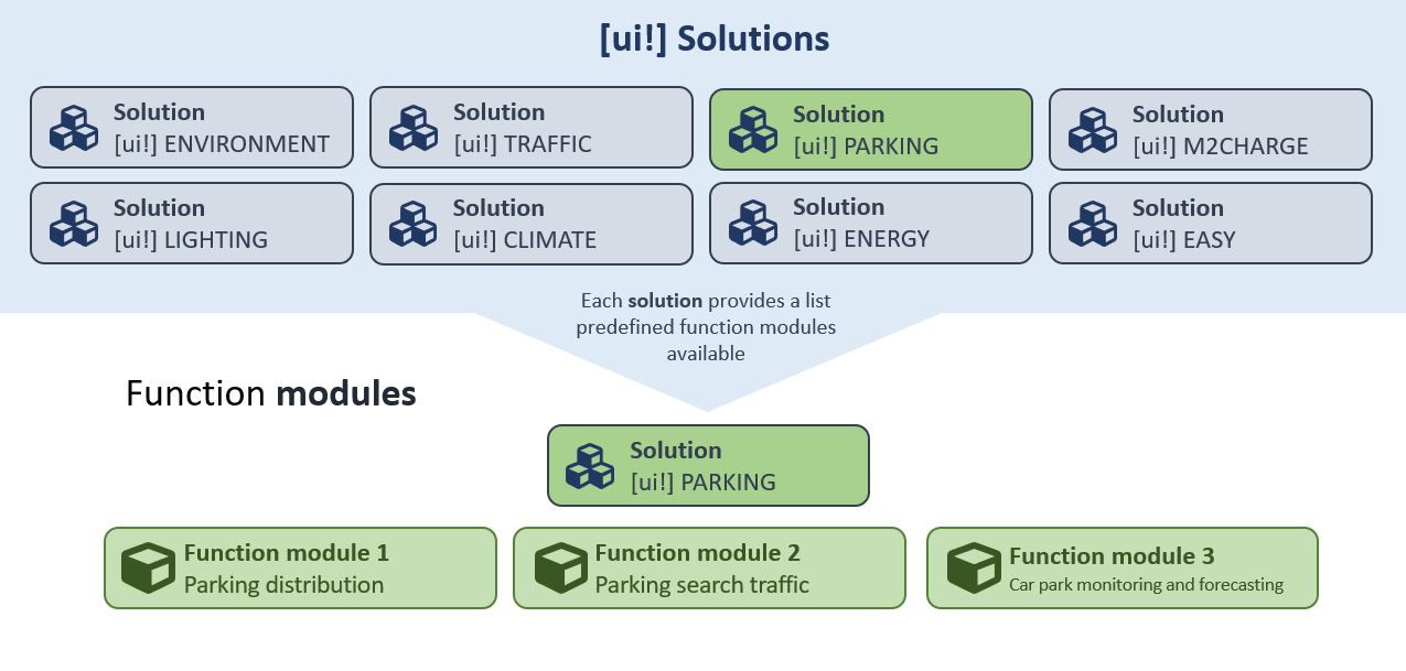
The [ui!] PARKING solution addresses important issues in our solution portfolio relating to data-supported parking management in local authorities. [ui!] PARKING is made up of the three functional modules parking distribution, parking search traffic, and parking monitoring and forecasting, each of which deals with its own sub-topic.

We all know it: the desperate search for a free parking space, congested access roads and overcrowded car parks that lead to considerable parking pressure and unnecessary traffic searching for parking spaces. Especially in economic regions or tourist and excursion areas, high volumes of commuter and leisure traffic often lead to overloaded transport infrastructures.

It is precisely these challenges that we are addressing. With [ui!] PARKING, we offer a customised solution that enables local authorities to monitor parking activities, plan parking infrastructure and manage parking traffic more efficiently.

The best thing about it: you receive these fundamental insights and decision-making aids without the need for comprehensive measurements or complex traffic planning analyses. For [ui!] PARKING, we use position data sent by vehicles for selected function modules, so-called FCD - Floating Car Data.

This data describes the movement of vehicles in the road network. It is a data type with a common standard in the transport sector. The data is available to [ui!] for the whole of Germany and is used to create the desired analyses.

For other function modules, locally installed sensors such as ground sensors or overhead cameras are used to record the necessary data.

Functionalities

  • The parking distribution function module analyses the number of parking processes in a specific spatial unit.

  • The parking search traffic function module analyses the traffic generated by the search for available parking spaces.

  • The parking space monitoring and forecasting function module enables data-based monitoring and forecasting of parking space utilisation.

Who is [ui!] PARKING aimed at?

Would you like to focus on your professional work?

As a user, you benefit from our software-as-a-service offering, which allows you to concentrate fully on your digitalisation projects. Your data is securely collected, stored, processed and visualised as part of our professional service. We recognise the limited human resources of small and medium-sized municipalities and have therefore developed [ui!] PARKING so that you can concentrate fully on your specialist tasks.

Would you like to make data-based decisions?

The digitalisation of the public sector generates municipal data as part of digital applications and municipal infrastructures using digital measurement and control devices. This data is often stored in silos of municipal infrastructures and is used in a specialised and isolated manner. As [ui!] PARKING is based on the open urban data platform - [ui!] UrbanPulse, you can combine data from different data sources and visualise it in a targeted manner.

Are you looking for digital added value for professionals AND citizens?

The [ui!] PARKING products integrate seamlessly into the market-proven open urban data platform [ui!] UrbanPulse, as well as into the successful smart city visualisation tool for citizens, the [ui!] COCKPIT. The functional modules are also available as web-based specialist applications, which visualise the data for specialist users in our [ui!] DATALAB.

[ui!] PARKING at a glance

The [ui!] PARKING solution is made up of the following function modules:

  • Parking distribution
  • Parking search traffic
  • Parking space monitoring and forecasting

Each of these modules deals with a separate issue in the context of stationary vehicle traffic.

Standards and cooperation

The digitalisation of the public sector generates municipal data as part of digital applications and municipal infrastructures using digital measurement and control devices.

This data is often stored in silos of municipal infrastructures and is used in a specialised and isolated manner.

By using an open urban data platform in accordance with DIN SPEC 91357, this data can be securely brought together in a central location.

The [ui!] PARKING portfolio of function modules is based on the [ui!] UrbanPulse open data platform.

Data from different data sources can be combined and visualised in a targeted manner in order to create the tools for a comprehensive picture of a municipality's key parking concerns.

As a central component of the municipal mobility strategy, [ui!] PARKING docks perfectly with the [ui!] TRAFFIC and [ui!] ENVIRONMENT solutions. In combination, these solutions provide you with a comprehensive picture of your municipality's key transport issues and are suitable building blocks for implementing your mobility and environmental strategies on the basis of solid data.

Visualisation and decision support

At [ui!], we believe that municipal digitalisation must be considered and communicated holistically. That's why our solutions ensure that the evaluation results can be visualised both internally and externally.

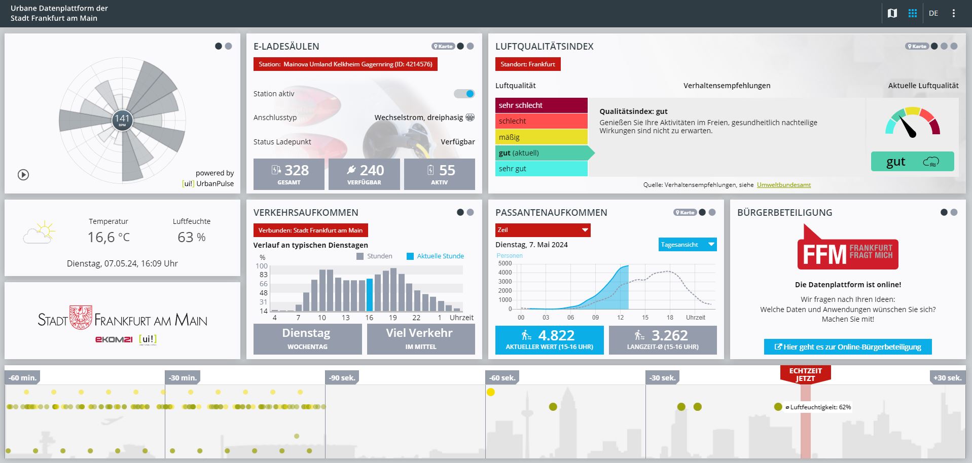
  • The [ui!] COCKPIT is the option to visualise processed data for citizens. With the help of a public smart city cockpit, you can provide the public with aggregated information about the local environment.

    COCKPIT Frankfurt

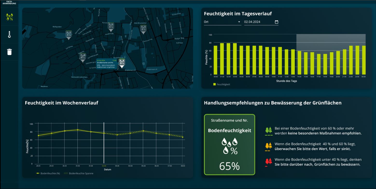
  • The [ui!] DATALAB is the tool for advanced environmental data analyses that provides specialist users with a municipal situation picture (e.g. climate managers, digitalisation department, and many others). It integrates seamlessly into [ui!] UrbanPulse and thus promotes cross-departmental collaboration.

    COCKPIT Frankfurt

Connection and connectors

If external data from existing systems or in-house sensor technology is to be integrated, it must be connected to the Open Urban Data Platform via a so-called connector.

Konnektorenliste

All use cases that we have tested and preconfigured can be selected from our standard set of use cases for specific topics.

The prerequisite is that your data sources can be connected with existing connectors from our [ui!] connector library.

The visualisation, which is based on the standard tile catalogue without any changes, is pre-configured by you using the configurator and then created for you by us.

If no connector is available for your desired system, we can develop a connector for you. Please discuss this option with us directly.

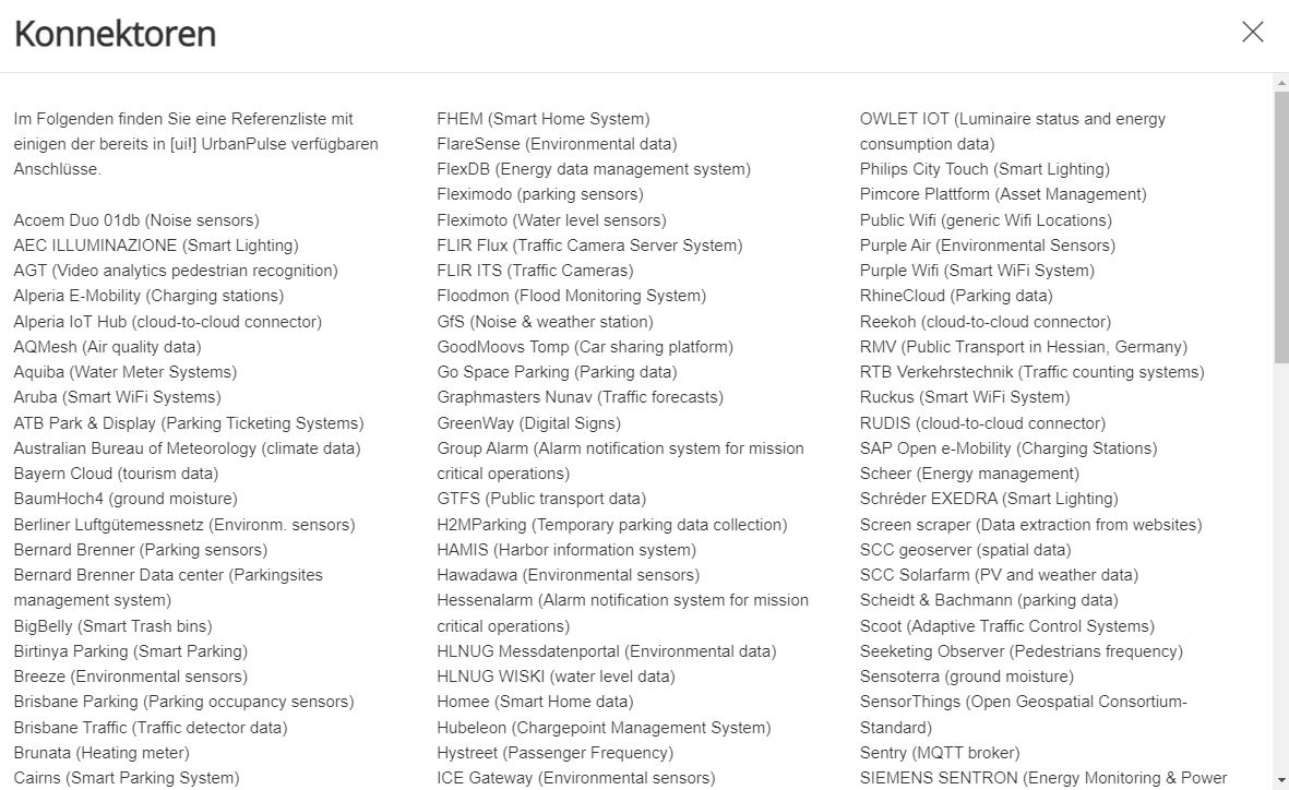
Connectors

Below you will find a reference list of some of the connections already available in [ui!] UrbanPulse.

Acoem Duo 01db (Noise sensors)
AEC ILLUMINAZIONE (Smart Lighting)
AGT (Video analytics pedestrian recognition)
Alperia E-Mobility (Charging stations)
Alperia IoT Hub (cloud-to-cloud connector)
AQMesh (Air quality data)
Aquiba (Water Meter Systems)
Aruba (Smart WiFi Systems)
ATB Park & Display (Parking Ticketing Systems)
Australian Bureau of Meteorology (climate data)
Bayern Cloud (tourism data)
BaumHoch4 (ground moisture)
Berliner Luftgütemessnetz (Environm. sensors)
Bernard Brenner (Parking sensors)
Bernard Brenner Data center (Parkingsites management system)
BigBelly (Smart Trash bins)
Birtinya Parking (Smart Parking)
Breeze (Environmental sensors)
Brisbane Parking (Parking occupancy sensors)
Brisbane Traffic (Traffic detector data)
Brunata (Heating meter)
Cairns (Smart Parking System)
Cambio (Car sharing platform)
Casambi (Smart Lighting)
Chargecloud (Charging stations)
ChargeIt (Charging data)
ChargePointOperator (OCPI Charging data)
Cisco Meraki (Smart WiFi Systems)
Civento (Construction Sites)
Clean City Networks (Waste bin data)
Cleverciti OffStreet (Parking Management)
Cleverciti OnStreet (Parking Management)
Cleverciti Ticks (Parking Management)
Cologne Parking (Parking garages data)
Cologne Traffic (Traffic flow data, Traffic Obstructions)
Comark Laser Scanner (Bike detection sensors)
Connctd IoT (Smart Home System)
Continental Carsharing (Car sharing platform)
Corona Incidence Report (COVID-19 Situation)
Count and Care (MQTT connector)
Crossfleet (Car sharing platform)
CSV Data (generic data import)
Datex II (traffic data)
DB ParkSpace (Parking Data)
DB Flinkster (Car Sharing)
DB Call a Bike (Bike Sharing
DEFAS (Public Transport data)
DFKI onboard Unit (Car Telemetry Interface)
Discovergy (Smart Meter data)
Duo Smart Noise (Noise sensors)
Eco-counter (Traffic count data)
e-sensio urban SmartBox (Environmental Sensors)
EarthSense (Air Quality)
EDIFACT MSCONS (Energy Data)
Eluminocity (Charging data)
Emio (Environmental sensors)
EnBW Sm!ght (Smart lamp post, Environmental Sensing & EV Charger)
Enevo (Waste bin data)
e-netz InfoMap (Construction Sites)
Entega (Energy Distribution Grid)
Feratel (Event Calendar)
FHEM (Smart Home System)
FlareSense (Environmental data)
FlexDB (Energy data management system)
Fleximodo (parking sensors)
Fleximoto (Water level sensors)
FLIR Flux (Traffic Camera Server System)
FLIR ITS (Traffic Cameras)
Floodmon (Flood Monitoring System)
GfS (Noise & weather station)
GoodMoovs Tomp (Car sharing platform)
Go Space Parking (Parking data)
Graphmasters Nunav (Traffic forecasts)
GreenWay (Digital Signs)
Group Alarm (Alarm notification system for mission critical operations)
GTFS (Public transport data)
H2MParking (Temporary parking data collection)
HAMIS (Harbor information system)
Hawadawa (Environmental sensors)
Hessenalarm (Alarm notification system for mission critical operations)
HLNUG Messdatenportal (Environmental data)
HLNUG WISKI (water level data)
Homee (Smart Home data)
Hubeleon (Chargepoint Management System)
Hystreet (Passenger Frequency)
ICE Gateway (Environmental sensors)
INCOTEC (Passenger Frequency)
INRIX (Parking data)
Intelliport IPS-403 NB-IoT (Traffic Sensor)
JSON Schema (generic data import)
KairosDB (Timeseries Database Connector)
Kerlink LoRa IoT Station (LoRaWAN Gateway)
Kimley Horn KITS (Traffic data)
Klimaherzen (CO2-Savings Incentive system)
KNX (Building Management System)
KVB (Public transport station data)
LanUV (NRW environment data)
Las Vegas Traffic (Traffic detector & signal state data)
Libelium Plug&Sense Smart City (Sensor devices)
Libelium Plug&Sense Smart Environment (Sensor devices)
Libelium Plug&Sense Smart Environment Pro (Sensor devices)
LuenNi (Niedersachsen environment data)
manageE (per second energy meter)
Marine traffic (Ship monitoring system)
MDM (moblity data marketplace)
Mobileeee (e-Carsharing data)
Modality (Container management system)
Modbus (Building Management System)
MOL BuBi (Hungarian bike sharing platform)
MQTT (generic MQTT Receiver)
Mr. Fill (Smart Trash bins)
Munisense (Noise sensors)
Netatmo (Environmental Sensors)
nextbike (Bike sharing platform)
Node Red (Data flow system)
NXP (RFID tag data)
NYC Traffic (Traffic detector & signal state data)
OCIT-C (Standard for Traffic Management Systems)
OCPI Last Mile Solutions (EV charging)
Olbring (water level sensors)
One M2M (cloud-to-cloud connector)
OpenWeatherMap (Weather data)
OWLET Nightshift (Luminaire status and energy consumption data)
OWLET IOT (Luminaire status and energy consumption data)
Philips City Touch (Smart Lighting)
Pimcore Plattform (Asset Management)
Public Wifi (generic Wifi Locations)
Purple Air (Environmental Sensors)
Purple Wifi (Smart WiFi System)
RhineCloud (Parking data)
Reekoh (cloud-to-cloud connector)
RMV (Public Transport in Hessian, Germany)
RTB Verkehrstechnik (Traffic counting systems)
Ruckus (Smart WiFi System)
RUDIS (cloud-to-cloud connector)
SAP Open e-Mobility (Charging Stations)
Scheer (Energy management)
Schréder EXEDRA (Smart Lighting)
Screen scraper (Data extraction from websites)
SCC geoserver (spatial data)
SCC Solarfarm (PV and weather data)
Scheidt & Bachmann (parking data)
Scoot (Adaptive Traffic Control Systems)
Seeketing Observer (Pedestrians frequency)
Sensoterra (ground moisture)
SensorThings (Open Geospatial Consortium-Standard)
Sentry (MQTT broker)
SIEMENS SENTRON (Energy Monitoring & Power Distribution)
SIEMENS (Traffic Management Systems)
Smart City Systems (Parking Data)
Smart Link (Irrigation data)
Spot (Environmental Sensors)
SPP Analytics (Signal Phase Timings)
Stadtwerke Aalen (Parking management)
Sustainder Brokerage (Smart Lighting)
SWARCO KR (Traffic Management System)
SWARCO TMS (Traffic Management System)
Swisstraffic (Traffic detector data)
Tier Mobility (Scooter Sharing)
Tom Tom (Traffic data)
Translink (Public transport data)
Tüga Plusportal (Smart Wifi System)
TVILIGHT (Smart Lighting)
[ui!] TRAFFIC (inner City traffic density)
Vaisala (Environment – receives pushed data)
Vaisala beacon cloud (Environment sensors)
Vaisala Mobile Detector (road conditions)
Vaisala WX Horizon (road conditions)
Vaisala Xweather (Environment sensors)
VDH (Traffic counting & video)
Vivacity Labs Tracks (Traffic management)
Vivacity Labs V2 (Traffic management)
Vivarium (Smart Zoo)
Viom Floating Car Data (FCD)
WaveScape (Crowd based sound measurement platform)
Wikidata (City Info)
Wordpress (Newsfeed)
YellowMap (Charging stations in Germany)
Ymatron (Waste bin data)
Zenner ElementIoT (LoRaWAN network server)
Zendesk (Ticketing system)
Zeta (Charging controller)
ZTIX (Event Calendar)

Further connectors are currently under development...

Get started right away - With the data from [ui!]

The parking distribution and parking search traffic function modules of [ui!] PARKING are based on the analysis of data that is already available to us, so you do not need to tap into any other data sources to use our solutions.

Specifically, we use position data sent by vehicles for [ui!] PARKING, so-called FCD - Floating Car Data. This data describes the movement of vehicles on the road network.

Since mid-2018, [ui!] has been receiving floating car data (FCD) from up to 500,000 road users daily via a corresponding data provider as a data stream with a latency of approx. 60-90 seconds and a sampling rate of 3-15Hz. Over time, a corpus of over 25 terabytes (as of Dec 2023) has been created here, which is available for analytical questions related to traffic.

Data from locally installed sensors is required to use the "car park monitoring and forecasting" function module. The smart city marketplace [ui!] AGORA offers various technologies for this purpose, such as overhead cameras (https://agora.umi.city/de/infrastruktur/smart-parking-air) oder Floor sensors (https://agora.umi.city/de/infrastruktur/smart-parking-boden).

If you would like to integrate a logo or coat of arms of the city to be displayed in your municipal [ui!] climate protection monitor, please send it to us in SVG format.

Car park distribution

The parking distribution function module analyses the number of parking processes in a specific spatial unit. If increased parking in the neighbouring side streets at business premises or P + R locations is identified and classified, this indicates potential congestion.

This function module enables you to ...

  • analyse areas with high parking volumes and potential overuse of parking spaces by determining parking processes and their relative distribution.

  • record important indicators in order to review the existing car park concept to ensure that it is up-to-date and to create measures for a new car park concept.

With reference to a specific example, the parking distribution function module helps to analyse undesirable parking in safety-critical areas (e.g. on roadsides) in tourist regions and to specifically avoid this through attractive parking concepts (stopping bays, intelligent signage).

The parking distribution function module analyses the number of parking processes in a specific spatial unit. If increased parking in the neighbouring side streets at business premises or P + R locations is identified and classified, this indicates potential congestion.


Added value in municipal use

Added value in municipal use

The parking distribution function module can be used for various traffic-related tasks such as the continuous monitoring of existing parking infrastructure or when planning new parking infrastructure, as well as for the management of parking traffic at major events. In addition, the analysis results for parking distribution can be used as an important input parameter for a data-based location analysis in the retail sector or for measuring the attractiveness of properties.

Decisive added values of the parking distribution function module are:

  • Reducing the search for a parking space:By analysing parking traffic data, urban decision-makers and specialist users (e.g. traffic planners) can gain insights into the availability of parking spaces and develop solutions to minimise the search for parking spaces for drivers.

  • Improve traffic flow: Urban decision-makers can analyse traffic data to identify bottlenecks and bottlenecks in traffic flow and take measures to improve traffic flow, for example by suggesting alternative routes or optimising signal control.

  • Reduce environmental impact:By reducing search traffic and congestion, data-based parking traffic analysis can help to reduce the environmental impact of exhaust fumes and noise.

  • Support planning and development:Analysing parking traffic data can help clients make informed urban planning and development decisions by providing insights into parking usage and traffic patterns.
Selection [ui!] DATALAB

Selection [ui!] DATALAB

A Kepler-based web application for the spatial representation of parking distribution analysis data and filter options for different time periods is provided as a specialised application.
The figure below shows an interactive map for visualising the parking distribution

Technical description

Technical description

Areas with high parking volumes are identified on the basis of floating car data (vehicle movements measured by navigation devices and / or mobile devices) and are made available for motorised private transport. A detailed description of the data fields included can be found below.

The analysis covers the period of the last 15 weeks prior to the order. Spatial cells are differentiated with an edge length depending on the size of the area under consideration (100 m-10 km), as well as a differentiation between weekday / weekend and four different traffic-relevant day phases as time slices.

The parking processes are recognised and classified as such in the floating car data (FCD) of a region with the help of a machine learning model. For this purpose, transitions in which a vehicle falls below a certain minimum speed are searched for in each sequence of telemetry data. For each of these transitions, various properties are extracted from the driving behaviour of the previous minute and the two following minutes. These properties are then used as a basis for the machine learning model to make a classification decision (parking process / stop at traffic lights or stationary traffic).

The following data fields are provided as results of the analysis:

  • lat / lon: The latitude and longitude of the centre of a spatial cell in the EPSG:4326 (GPS / WGS84) coordinate system.

  • relative_parking: The relative number of parking events in the spatial cell. Normalised for the duration of the time slice in order to establish comparability between time slices.

  • day: The day or the day span for which a value was collected.

  • hour: The hour or the time span for which a value was collected

No further data sources are required for this function module, i.e. no connection of connectors. Floating Car Data (FCD), which is used by [ui!] to carry out the analyses, is used as the data source.

Parking search traffic

The parking search traffic function module analyses the traffic generated by the search for available parking spaces. This traffic parameter is considered one of the most important indicators for the development of mobility and parking space concepts. The aim of many mobility and parking concepts is therefore to avoid or significantly reduce parking search traffic.

This function module enables you to ...

  • determine areas with high levels of parking search traffic and the extent of parking search traffic by analysing parking search traffic.

  • introduce targeted countermeasures, such as a parking guidance system, to minimise parking search traffic and thus relieve traffic congestion and improve air quality by reducing emissions.

Added value in municipal use

Added value in municipal use

The parking search traffic function module provides you with an analysis of the traffic generated in your municipality when searching for available parking spaces. This parking search traffic has a negative impact on the traffic situation and, in general, on people and the environment due to the additional emissions generated for this purpose. Avoidance or reduction should be one of the objectives of mobility and parking space concepts in the context of sustainable urban planning.

The results of the analyses can be used to address various transport-related tasks in municipalities, such as the continuous monitoring of existing parking infrastructure or the planning of new parking infrastructure.

  • Expand car parks in line with demand: The analysis can be used to identify areas with high parking search traffic as well as its extent. The data obtained can be used to derive information that can be used to plan and locate the necessary parking space requirements, including a parking guidance system, in order to relieve the pressure on residents' car parks, for example.

  • Data-based location evaluation: The results of the analysis of parking search traffic can be used as an important input parameter for a data-based location analysis in the retail sector or for measuring the attractiveness of properties.

Control of parking traffic during traffic peaks: At major events, parking search traffic can be analysed and controlled accordingly. This helps to avoid bottlenecks and visitors can be directed to free parking spaces more efficiently.

Selection [ui!] DATALAB

Selection [ui!] DATALAB

The specialised application is provided in the form of a web-based interactive map. The results of the data analysis on parking search traffic are displayed geo-localised on the map. The interactive map allows users to customise the presentation of the data by setting filters.

Technical description

Technical description

Parking search traffic is determined on the basis of floating car data (vehicle movements measured by navigation devices and / or mobile devices) and is made available for motorised private transport. A detailed description of the data fields included can be found below.

The analysis covers the period of the last 15 weeks prior to the order. Spatial cells are differentiated with an edge length depending on the size of the area under consideration (100m-10km), as well as a differentiation between weekday / weekend and four different traffic-relevant day phases as time slices.

In a first step, the actual parking processes are analysed using a machine learning model. Then the previous telemetry points of parked vehicles in a 300 m neighbourhood are aggregated into the individual cells and time slices.

The following data fields are provided as results of the analysis:

  • lat / lon: The latitude and longitude of the centre of a spatial cell in the EPSG:4326 (GPS / WGS84) coordinate system.

  • parking_search_pct: The percentage of vehicles in a spatial cell searching for a parking space.

  • relative_parking: A measure of the relative parking volume in the spatial cell as a whole. Standardised for the duration of the time slice in order to establish comparability between time slices.

No further data sources are required for this function block, i.e. no connection of connectors. The data source used is Floating Car Data (FCD), which is used by [ui!] to perform the analyses

Car park monitoring and forecasting

The parking space monitoring and forecasting function module enables data-based monitoring and forecasting of parking space utilisation.

By recording and analysing the current occupancy of parking spaces using sensors and cameras, local authorities and their drivers can obtain an accurate real-time display of available parking spaces on a map.

This function module enables you to ...

  • using data-based parking space monitoring and the forecasts based on this to efficiently manage the use of parking spaces, identify bottlenecks and take timely measures to optimise parking space availability.

  • improve the flow of traffic in your municipality and reduce environmental pollution through this targeted control.

Added value in municipal use

Added value in municipal use

The parking space monitoring and forecasting function module provides local authorities with a powerful tool that enables them to monitor the use and availability of parking spaces in real time and predict future developments.

An overview of the added value of this function module:

  • More efficient parking space management: By continuously recording and analysing occupancy data, local authorities can closely monitor the use of parking spaces and react quickly if necessary. Measures such as the dynamic adjustment of parking charges or the introduction of parking guidance systems can be implemented in a targeted manner. Early detection of bottlenecks and targeted traffic management can make it easier to find a parking space at major events, for example.

  • Optimised planning of parking infrastructure: With data-based insights, municipalities can identify areas with high demand and make needs-based decisions, such as the placement of new parking spaces and the improvement of existing facilities. Forecasts of future demand enable proactive planning. Historical occupancy data as well as external contextual information such as weather data are included in the calculation for the forecasts. By utilising the data that is added over the term, the forecasts are continually adapted and improved.

  • Combining recording technologies: The use of different recording technologies such as camera and ground sensor systems offers local authorities a flexible and comprehensive data basis. This diversity makes it possible to collect data on car park utilisation at different levels of granularity depending on local requirements. This promotes long-term, well-founded decisions and supports effective car park management.
Selection [ui!] DATALAB

Selection [ui!] DATALAB

The specialised application of the parking space monitoring and forecasting function module is provided as a [ui!] DATALAB. The illustration shows four visualisations of different aspects of parking space monitoring and forecasting.

Technical description

Technical description

Depending on the characteristics of your car parks, different technical sensor or camera-based solutions are used in the parking space monitoring function module. These are not part of the [ui!] PARKING solution and are assumed to be an existing installation for the car park monitoring function module. If no sensor technology has yet been installed, this can be ordered, for example, via the Smart City marketplace [ui!] AGORA (https://agora.umi.city) be obtained.

Three different types of sensor technology for car park monitoring are presented below.

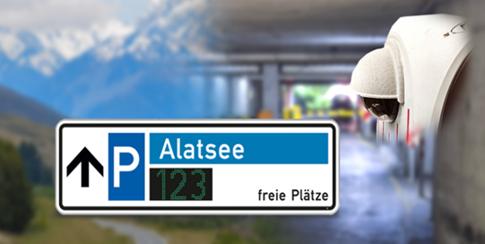
  • With the help of a camera system or ground sensor system at the entrances/exits of a car park, a balance of the currently occupied parking spaces can be drawn up. Each entry of a car is added, each exit is subtracted.

Bild15Balancing camera system for car park monitoring

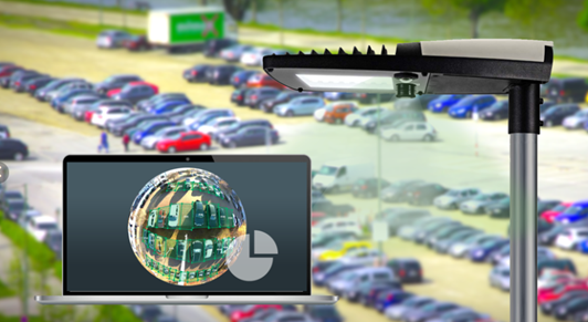
  • Overhead sensors (mounted on light poles or integrated into LED lights, for example) and an AI-supported computer vision system recognise free parking spaces and forward them as data records. This solution is particularly suitable for large, open car parks with unclear access situations.

Überkopf-Kamerasystem zur Erfassung der Belegung von ParkflächenOverhead camera system for recording the occupancy of car parks 

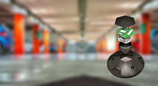
  • Floor sensors (embedded or mounted on parking space surfaces) are used to precisely detect whether a parking space is occupied. In further expansion stages, active car park management can also be implemented. For this purpose, special rights (e.g. residents' parking) are stored on NFC chip cards; these cards can then be placed in the glove compartment, for example. The floor sensors detect whether the vehicle is equipped with an authorisation and issue an alarm at a central location if this is not the case.

Überkopf-Kamerasystem zur Erfassung der Belegung von ParkflächenFloor sensor for recording the occupancy of car parks

Would you like to find out more about our solutions?

We are also happy to assist you at our branches in Berlin, Darmstadt, München, Walldorf oder Chemnitz are available for a demonstration or will visit you on request.