")
Urban data platform from [ui!] shows exact air temperature in Frankfurt
City of Frankfurt responds to ever-increasing temperature fluctuations
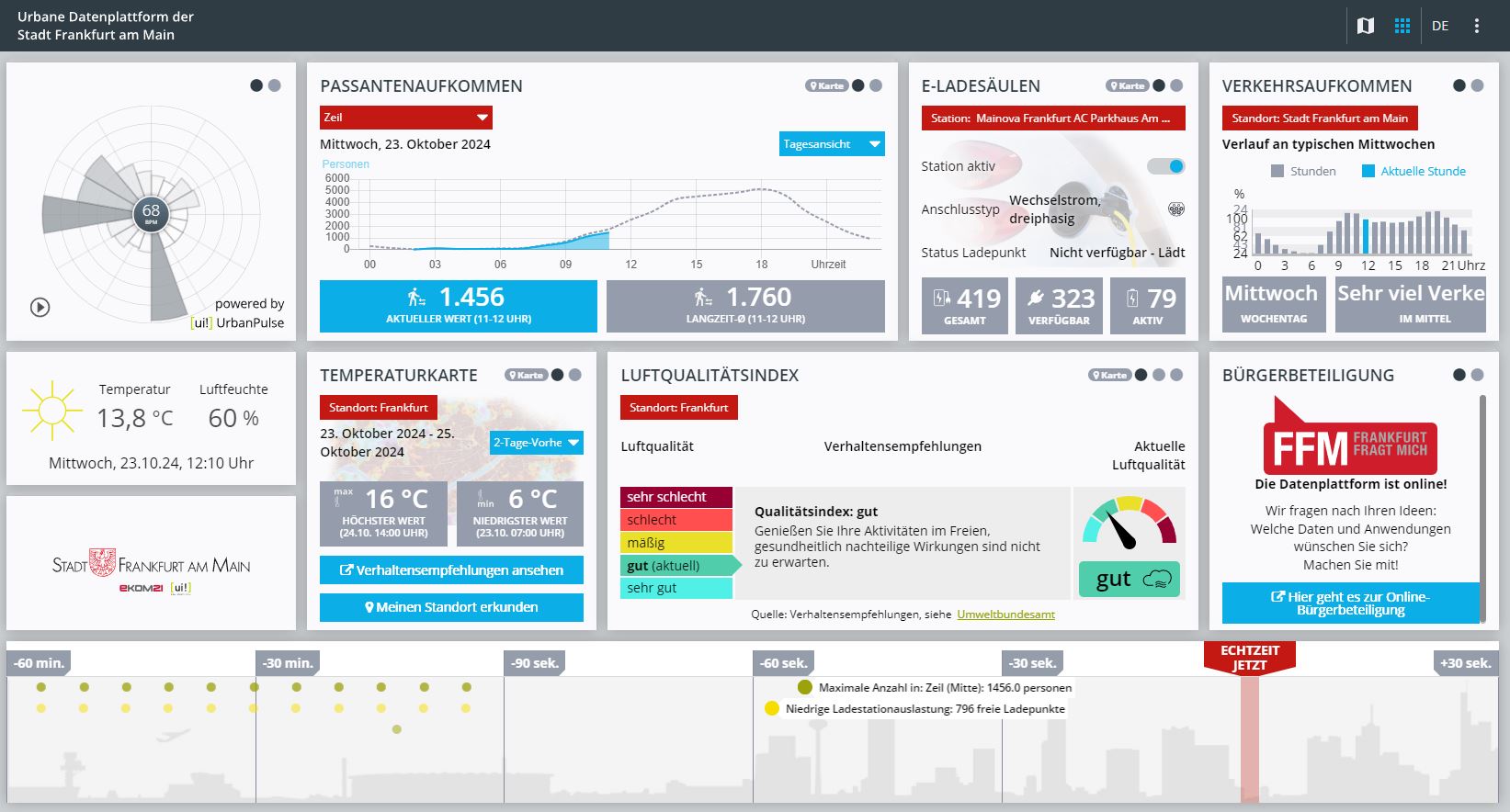
The Urban Data Platform Frankfurt (UDP) has been in operation since October 2022 and visualises useful information for citizens on dashboards and maps, such as the nearest e-charging station, information on air quality or traffic and pedestrian volumes. More data has now been added: The UDP now also shows which parts of the city are particularly hot and where it is particularly cool. The Digitalisation Unit has provided the corresponding temperature maps in cooperation with the Health Department and the Climate Department.
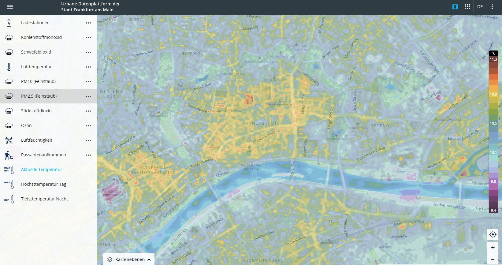
"Due to climate change, we are also experiencing increasingly hot summers in Frankfurt, which pose a serious health risk, especially for vulnerable groups such as the elderly, pregnant women, children and the chronically ill," says City Councillor Eileen O'Sullivan, the department head responsible for digitalisation. "Using the new temperature maps, Frankfurt's citizens can now see exactly which areas of the city have heat islands and where it is still comparatively cool at ten by ten metres. This allows vulnerable groups to avoid particularly hot places in summer. At the same time, in winter, the detailed temperature maps make it possible to recognise in which areas of the city frost and icy conditions are to be expected."
About the new temperature maps in the urban data platform
The temperature maps on the urban data platform Urbanen Datenplattform Frankfurt show the air temperature in a specific area to an accuracy of ten times ten metres. The dashboard displays the highest and lowest temperatures in the city area. The data is provided byMeteoblue.
Source: https://frankfurt.de/